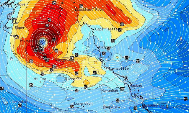
Port Douglas and Cairns likely to escape cyclonic conditions
Published Tuesday 22 December 2015

Weather experts and popular cyclone observers Higgins Storm Chasers predict that the monsoonal trough is likely to pass down the east coast but cyclonic wind conditions are likely to dissipate as the low moves over land and south towards Townsville.
From Higgins Storm Chasers:
• A Tropical Low 1003hpa has developed over land in the South Western Gulf which is expected to slowly intensify. Once over Gulf waters, this low is forecast and has a high chance to develop into a Tropical Cyclone during this week. Exact formation and coastal crossing times vary between 24th and the 27th for the cyclone or tropical low to cross the South East Gulf coast region. It is then forecast to continue to track South East through Georgetown to be located as an Ex TC or Tropical Low over Townsville on Boxing Day however this has some uncertainly.
• A monsoon trough extends across the North QLD Peninsula which is expected to intensify and shift south from Cape Flattery, through Cairns and down to Townsville over the next 3 days.
• Scattered showers, gusty storms and rain areas with moderate to locally heavy falls expected in the Gulf and adjacent inland areas, Peninsula and North QLD Tropical Coast and adjacent inland areas over the next 3 days. Flash Flooding is possible, some river and creek flooding may occur.
From BOM:
At the time of this article the Bureau of Meteorology was still showing No Current Cyclone Warnings for Australia.
--------------------------------------
Visiting Port Douglas over Christmas?
Read 10 things to do in Port Douglas in the rain
--------------------------------------
